
Tags
Argentina, Beagle Channel, Fin del Mundo, hike, Martial Glacier, Patagonia, Tierra del Fuego, Travel, Ushuaia
Martial Glacier is easily the most popular hike in Ushuaia, probably because there is easy access, it offers great views of Beagle Channel, and it’s not particularly long. If I’m being honest, I wasn’t overly excited about this one. I was expecting it to be a bit ‘blah.’ Particularly after Laguna Esmerelda. It didn’t help that there is a wealth of spectacularly crappy photos of this hike floating around the interwebs, so my expectations of it were pretty low. However, we had an afternoon flight out of Ushuaia, so a bigger or more remote hike was not practical for the time we had available to us and I’m so glad we did it. It surpassed expectations at every level. I’ll try to document it with greater detail than I was able to find in my trip research so people planning travels there can have a better idea of what to expect. For such a well travelled trail, GOOD information on it was hard to come by.
We awoke with the sunrise and headed out shortly thereafter. There are a couple of different ways you can do this trail. You can start directly from town…which makes it a much longer hike, or you can drive to the base of ski area and start there. We drove up to the base and were entering the trail at 8AM. There was not another soul in sight. In fact, we had the entire mountain to ourselves for most of the morning. As I’ve mentioned in other posts, this is not a region that gets an early start to the day. We didn’t see anyone else until we were well on our way down. Given the popularity of the trail, I recommend an early start. There’s something special about being up there all alone.
You enter the trail here, by a small cafe:
You immediately have a choice to make. You can go up the main road (to the left) OR you can take the trail to the right (more in the center of this photo) that runs by the river. This is what I recommend. It is much prettier and the grade is slightly less steep. We would not have known this trail existed had we not been on the main road the other evening to play around with the drone. We were glad we knew where we were going and had learned about the side trail before doing the hike. 
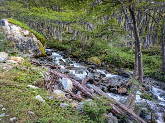
The trail to the left is pretty much just a big dirt road. But if you head to the right, here is a sampling of what that trail looks like:

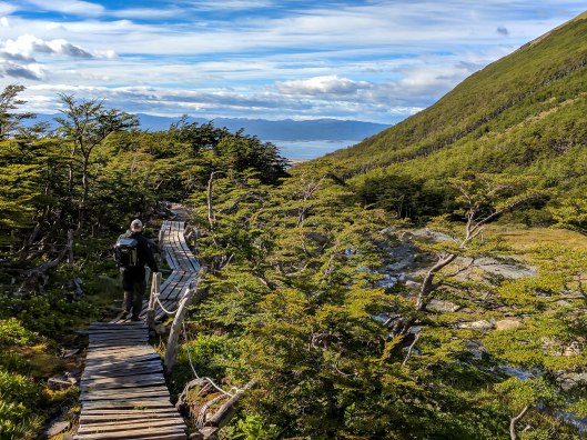
Eventually, you end up back on the main road where you cross a bridge and continue up to the viewing area. What we discovered on the way back down is that there is another trail, even prettier, that you can take to the viewpoint. See the lodge to the right? If you head back towards it, you’ll find a path that leads up through some really pretty trees. It spits you out right at the glacier viewpoint. Photos of that later. We took that route upon our return.

From the bridge the trail continues to the right of the river. The lodge with the alternate path is to the right of where this photo was taken:

If you continue on the main trail, you’ll cross a second small bridge to the viewpoint, which is to the right of this photo:
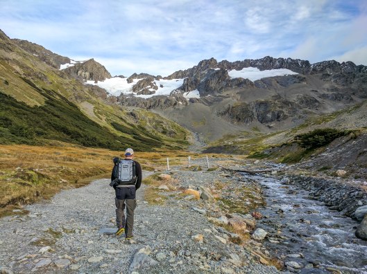
Excuse the bad photo, but here you can see there are benches and an informational sign about wildlife in the area. My guess is that this is where many people end their hike. It took us half an hour to get to this point. We weren’t hiking particularly fast.
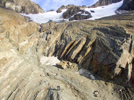
 From here we continued on to the glacier. The entire hike is somewhat steep but it gets particularly steep at the end of this second half.

Here you can see the whole scope of your view. The panorama makes everything look smaller but off to the left is Beagle Channel and to the right is Martial Glacier.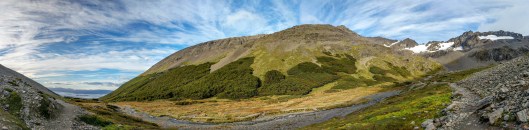
It took us about 40 minutes from the first view point to get to the end of the hike: 
Here is the view from the top. You can see all of Ushuaia and Beagle Channel as well as Isla Navarino behind:
We stayed at the top for a while, enjoying the view, loving having the place to ourselves, and Andy played around with the drone to his heart’s content. Here are a couple of shots he took with the drone:

Eventually we made our way back down, where we found that alternate trail:


We stopped for a lovely cup of hot chocolate at the cafe: 
It was the perfect adventure that left us with plenty of time get ourselves ready to head on to another region of Patagonia.

Thanks so much for writing this. We’ve just returned from the hike up to the glacier and having first read your post our day was definitely much improved. I agree, it is tough finding useful information on the walk so reading your report was most welcome and very useful. Cheers!
I’m so glad it helped! Thanks for the feedback. Enjoy your time in Tierra del Fuego!
Hi! Thank you for this write up. I concur with what you said about the spectacularly crappy photos of this hike online, to the point I had planned on skipping this activity. Your post has made me reconsider. Do you remember how much time the hike took you from start to finish?
Hi Carissa, I’m sorry I was out of town and didn’t see this sooner. It took us an hour and ten minutes to get to the top and we were not hiking quickly. I’m sorry I don’t remember how long we took to get down but I know it was quicker than on our way up. I hope that at least gives you a reference to start with! I’m glad you’re reconsidering it. It’s a pretty little hike. ENJOY your time there!!
Hi Sarah!
Am planning to head there and your post has definitely helped to make preparations especially I am hiking alone.
Cheers and thanks for making the effort to write!
Oh I’m so glad this was helpful! Can’t believe I’m just seeing this comment somehow. Hope you have/had an amazing trip!!
Hi Sarah,
Thankyou for the great details of this hike. We are in our late 60s and I needed to know whether it would be in our comfort zone. After your detailed review we feel more than comfortable to do it. Many thanks Judy and Ken Australia
You’re welcome! So glad it was helpful. Hope you enjoy the hike!!